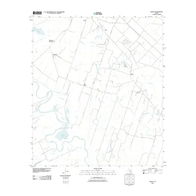
2010 Map of Bonus
USGS Topo · Published 2010About this map
The Colorado River defines the western edge of this landscape in Colorado County, where the river's winding course creates a series of oxbows and secondary waterways like Robb Slough. This 2010 survey shows a rural Texas expanse organized around small settlements such as Bonus, Eldridge, and Elm Grove. The infrastructure is dominated by a grid of county roads and farm-to-market routes, including FM 102 RD and Sugarland RD, which connect these dispersed communities and agricultural lands.
Find a feature on this map
38 named features on this map. Tap any name to fly to it.
Don’t see what you’re looking for? This feature index may not catch every label — zoom into the map to look around manually.
Map Details
Editions of this 2010 Bonus Map
This is the sole edition of this map. No revisions or reprints were ever made.
Other maps of this area

1952 · Egypt
USGS Topo · 1:24,000

1953 · Glen Flora
USGS Topo · 1:24,000

1953 · Seguin
USGS Topo · 1:250,000

1956 · Wallis
USGS Topo · 1:62,500

1957 · Eagle Lake
USGS Topo · 1:62,500

1957 · Altair
USGS Topo · 1:24,000

1958 · Seguin
USGS Topo · 1:250,000

1959 · Garwood
USGS Topo · 1:24,000

1959 · Bonus
USGS Topo · 1:24,000

1960 · Lissie
USGS Topo · 1:24,000