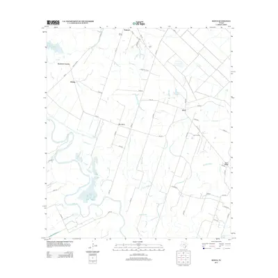
2013 Map of Bonus
USGS Topo · Published 2013About this map
The Colorado River meanders through the western portion of this Colorado County landscape, defining a terrain shaped by riparian bends and seasonal watercourses. Small settlements and rural junctions like Bonus, Matthews, and Boedecker Junction anchor the local geography, connected by a network of farm-to-market roads and county routes. The drainage patterns are particularly distinct here, with Robb Slough cutting a long path through the center and Peach Cr and Clarks Br feeding into the river system.
Find a feature on this map
46 named features on this map. Tap any name to fly to it.
Don’t see what you’re looking for? This feature index may not catch every label — zoom into the map to look around manually.
Map Details
Editions of this 2013 Bonus Map
This is the sole edition of this map. No revisions or reprints were ever made.
Other maps of this area

1952 · Egypt
USGS Topo · 1:24,000

1953 · Glen Flora
USGS Topo · 1:24,000

1953 · Seguin
USGS Topo · 1:250,000

1956 · Wallis
USGS Topo · 1:62,500

1957 · Eagle Lake
USGS Topo · 1:62,500

1957 · Altair
USGS Topo · 1:24,000

1958 · Seguin
USGS Topo · 1:250,000

1959 · Garwood
USGS Topo · 1:24,000

1959 · Bonus
USGS Topo · 1:24,000

1960 · Lissie
USGS Topo · 1:24,000