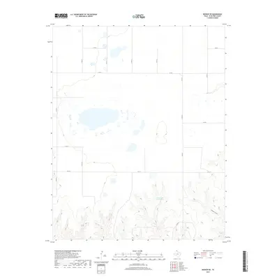
2019 Map of Booker SW
USGS Topo · Published 2019About this map
The High Plains of Ochiltree County are defined here by a vast, organized grid of section roads and isolated drainage basins. Unlike the more broken terrain found elsewhere in the Texas Panhandle, this area maintains a starkly geometric layout, where routes like Co Rd 20 and Co Rd L facilitate access to the flat agricultural lands and scattered playa lakes. The most significant topographic relief occurs in the southeast, where the landscape begins to descend toward the Cottonwood Arroyo, revealing the erosional patterns typical of this portion of the Llano Estacado.
Find a feature on this map
13 named features on this map. Tap any name to fly to it.
Don’t see what you’re looking for? This feature index may not catch every label — zoom into the map to look around manually.
Map Details
Editions of this 2019 Booker SW Map
This is the sole edition of this map. No revisions or reprints were ever made.
Other maps of this area

1954 · Perryton
USGS Topo · 1:250,000

1958 · Perryton
USGS Topo · 1:250,000

1972 · Booker SE
USGS Topo · 1:24,000

1973 · Booker
USGS Topo · 1:24,000

1973 · Booker SW
USGS Topo · 1:24,000

1973 · Sourdough Creek NE
USGS Topo · 1:24,000

1973 · Perryton SE
USGS Topo · 1:24,000

1973 · Perryton
USGS Topo · 1:24,000

1973 · Lake Fryer
USGS Topo · 1:24,000
1973 · Lake Fryer NE
USGS Topo · 1:24,000