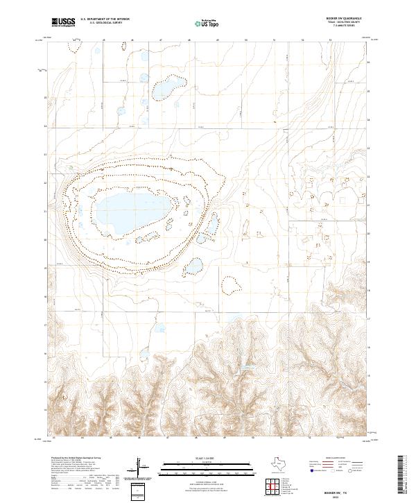
2022 Map of Booker SW
USGS Topo · Published 2022About this map
Wheatheart Feeders Lake dominates the central landscape of this Ochiltree County terrain, surrounded by a network of seasonal playas and depressions characteristic of the High Plains. The southern portion of the quadrangle transitions into the more dissected topography of Cottonwood Arroyo, where the drainage patterns become more pronounced against the flat upland plains. The section lines are defined by a rigid grid of local routes like Co RD 24 and Co RD K, reflecting the systematic land division used for agricultural and ranching operations in the Texas Panhandle. Modern transportation is anchored by FM 2711, which cuts across the territory as a primary east-west connector. This 2022 survey illustrates the enduring relationship between water management and rural infrastructure in an area where localized hydrography is central to the local economy.
Find a feature on this map
14 named features on this map. Tap any name to fly to it.
Don’t see what you’re looking for? This feature index may not catch every label — zoom into the map to look around manually.
Map Details
Editions of this 2022 Booker SW Map
This is the sole edition of this map. No revisions or reprints were ever made.
Other maps of this area

1954 · Perryton
USGS Topo · 1:250,000

1958 · Perryton
USGS Topo · 1:250,000

1972 · Booker SE
USGS Topo · 1:24,000

1973 · Booker
USGS Topo · 1:24,000

1973 · Booker SW
USGS Topo · 1:24,000

1973 · Sourdough Creek NE
USGS Topo · 1:24,000

1973 · Perryton SE
USGS Topo · 1:24,000

1973 · Perryton
USGS Topo · 1:24,000

1973 · Lake Fryer
USGS Topo · 1:24,000
1973 · Lake Fryer NE
USGS Topo · 1:24,000