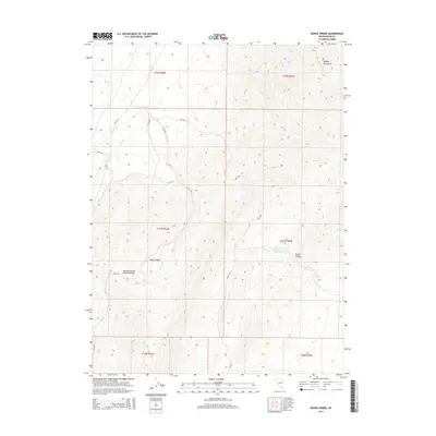
2015 Map of Boone Spring
USGS Topo · Published 2015About this map
Pequop Mountains dominate this high-altitude landscape in northeastern Nevada, showing a complex network of seasonal drainages and springs. The area is defined by the high pass at Pequop Spruce Mountain Pass, where the terrain transitions into the broad Coyote Basin. Water sources, while sparse, are critical landmarks here, including Boone Spring and Lower Boone Spring located near the mouth of Boone Canyon.
Find a feature on this map
23 named features on this map. Tap any name to fly to it.
Don’t see what you’re looking for? This feature index may not catch every label — zoom into the map to look around manually.
Map Details
Editions of this 2015 Boone Spring Map
This is the sole edition of this map. No revisions or reprints were ever made.
Other maps of this area

1953 · Spruce Mountain
USGS Topo · 1:62,500

1953 · Spruce Mountain 4
USGS Topo · 1:62,500

1955 · Elko
USGS Topo · 1:250,000

1958 · Elko
USGS Topo · 1:250,000

1962 · Elko
USGS Topo · 1:250,000

1965 · Elko
USGS Topo · 1:250,000

1982 · Mizpah
USGS Topo · 1:24,000
1982 · Mizpah Point
USGS Topo · 1:24,000
1984 · Palomino Ridge
USGS Topo · 1:24,000
1985 · Wendover
USGS Topo · 1:100,000