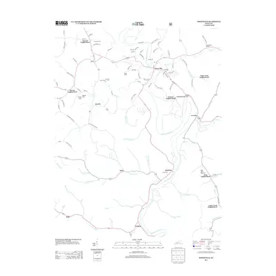
2013 Map of Booneville
USGS Topo · Published 2013About this map
The S Fork Kentucky River winds through the heart of this Owsley County landscape, anchoring the regional hub of Booneville. The settlement pattern follows the narrow creek valleys, with several named community enclaves such as Pleasant Neighborhood, Elk Lick Neighborhood, and Sugar Camp Neighborhood established along the hillsides. Local history is deeply embedded in the family-named landmarks and resting places that dot the terrain, including Pendergrass Cem, Shepherd Cem, and Mcintosh Cem.
Find a feature on this map
94 named features on this map. Tap any name to fly to it.
Don’t see what you’re looking for? This feature index may not catch every label — zoom into the map to look around manually.
Map Details
Editions of this 2013 Booneville Map
This is the sole edition of this map. No revisions or reprints were ever made.
Other maps of this area

1891 · Manchester
USGS Topo · 1:125,000

1892 · Beattyville
USGS Topo · 1:125,000

1952 · Tallega
USGS Topo · 1:24,000

1952 · Beattyville
USGS Topo · 1:24,000

1952 · Heidelberg
USGS Topo · 1:24,000

1953 · Oneida
USGS Topo · 1:24,000

1953 · Cowcreek
USGS Topo · 1:24,000

1953 · Mistletoe
USGS Topo · 1:24,000

1953 · Booneville
USGS Topo · 1:24,000

1953 · Sturgeon
USGS Topo · 1:24,000