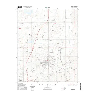
2015 Map of Booneville
USGS Topo · Published 2015About this map
Booneville serves as the central hub of this Prentiss County landscape, where the Northeast Mississippi Community Coll and significant civic spaces like Booneville Cem and Oaklawn Memorial Park anchor the local community. The terrain is defined by a complex drainage system, notably the Tuscumbia River and several creeks such as Pollys Cr and Hornolucka Cr, which create a rolling topography before giving way to the Piney Grove Hollow in the northeast.
Find a feature on this map
164 named features on this map. Tap any name to fly to it.
Don’t see what you’re looking for? This feature index may not catch every label — zoom into the map to look around manually.
Map Details
Editions of this 2015 Booneville Map
This is the sole edition of this map. No revisions or reprints were ever made.
Other maps of this area

1921 · Booneville
USGS Topo · 1:48,000

1922 · Booneville
USGS Topo · 1:62,500

1935 · Glens
USGS Topo · 1:24,000

1950 · Corinth
USGS Topo · 1:62,500

1950 · Glens
USGS Topo · 1:24,000

1950 · Altitude
USGS Topo · 1:24,000

1956 · Tupelo
USGS Topo · 1:250,000

1958 · Tupelo
USGS Topo · 1:250,000
1965 · Marietta
USGS Topo · 1:24,000

1972 · Jumpertown
USGS Topo · 1:24,000