
1965 Map of Marietta
USGS Topo · Published 1966About this map
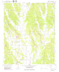
Marietta and the surrounding rural communities of Hobo Station and New Site anchor this mid-1960s study of Prentiss County. The landscape is defined by the valley of Big Brown Creek and its many tributaries, including Hurricane Creek and Sapling Creek. A prominent diagonal segment of the Natchez Trace Parkway cuts through the southwest, representing the modern iteration of this ancient travel corridor. The area's social fabric is visible through its numerous country churches and cemeteries, such as Candlers Chapel, Blythes Chapel, and Zions Rest Ch. On a high point overlooking the creeks, the Marietta Lookout Tower stands as a distinct landmark for fire observation. These features reveal a settled agricultural region where life centered on small town centers and the crossroads churches that served local families.
Find a feature on this map
30 named features on this map. Tap any name to fly to it.
Don’t see what you’re looking for? This feature index may not catch every label — zoom into the map to look around manually.
Map Details
Editions of this 1965 Marietta Map
2 editions found
Other maps of this area

1921 · Booneville
USGS Topo · 1:48,000

1921 · Tupelo
USGS Topo · 1:48,000

1922 · Booneville
USGS Topo · 1:62,500

1923 · Tupelo
USGS Topo · 1:62,500

1935 · Holcut
USGS Topo · 1:24,000

1950 · Paden
USGS Topo · 1:24,000

1950 · Altitude
USGS Topo · 1:24,000

1956 · Tupelo
USGS Topo · 1:250,000

1958 · Tupelo
USGS Topo · 1:250,000

1965 · Paden SE
USGS Topo · 1:24,000