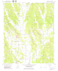
1965 Map of Marietta
USGS Topo · Published 1979About this map
Marietta serves as the focal point of this northeast Mississippi landscape, situated at a rural crossroads in southern Prentiss County during the mid-1960s. The region is defined by a dense network of small rural settlements and religious centers, including New Site and the curiously named Hobo Station. A proliferation of country churches and family-named landmarks, such as Blythes Chapel, Siloam Ch, and Massey Cem, suggests a deeply rooted community structure tied to the land's geography.
Find a feature on this map
34 named features on this map. Tap any name to fly to it.
Don’t see what you’re looking for? This feature index may not catch every label — zoom into the map to look around manually.
Map Details
Editions of this 1965 Marietta Map
2 editions found
Other maps of this area

1921 · Booneville
USGS Topo · 1:48,000

1921 · Tupelo
USGS Topo · 1:48,000

1922 · Booneville
USGS Topo · 1:62,500

1923 · Tupelo
USGS Topo · 1:62,500

1935 · Holcut
USGS Topo · 1:24,000

1950 · Paden
USGS Topo · 1:24,000

1950 · Altitude
USGS Topo · 1:24,000

1956 · Tupelo
USGS Topo · 1:250,000

1958 · Tupelo
USGS Topo · 1:250,000
1965 · Paden SE
USGS Topo · 1:24,000