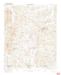
1921 Map of Booneville
USGS Topo · Published 1921About this map
Booneville serves as the primary hub in this northeast Mississippi survey, situated along the Mobile and Ohio railroad line. The landscape is characterized by a dense network of rural infrastructure, where nearly every township section is anchored by a neighborhood school or country church. Notable community landmarks include Morton Chapel, Crossroads Church, and numerous specialized educational sites like the Walnut Grove School and Carolina School.
Find a feature on this map
71 named features on this map. Tap any name to fly to it.
Don’t see what you’re looking for? This feature index may not catch every label — zoom into the map to look around manually.
Map Details
Editions of this 1921 Booneville Map
2 editions found
Other maps of this area

1921 · Booneville
USGS Topo · 1:48,000

1921 · Tupelo
USGS Topo · 1:48,000

1922 · Booneville
USGS Topo · 1:62,500

1923 · Tupelo
USGS Topo · 1:62,500

1935 · Glens
USGS Topo · 1:24,000

1950 · Corinth
USGS Topo · 1:62,500

1950 · Glens
USGS Topo · 1:24,000

1950 · Altitude
USGS Topo · 1:24,000

1951 · Walnut
USGS Topo · 1:62,500

1955 · Ripley
USGS Topo · 1:62,500