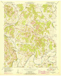
1951 Map of Boonshill
USGS Topo · Published 1996About this map
Swan Creek and its many tributaries, such as Little Swan Creek and Turney Branch, carve a complex network of valleys through this rural Tennessee landscape. This 1951 edition, updated with 1967 revisions, reveals a community structure centered on local gathering places and small settlements. Clusters of civic life are evident at Boonshill, home to the Boonshill Sch, and in outlying areas where family names define the terrain, from Reed Hollow to Sawyer Hollow.
Find a feature on this map
71 named features on this map. Tap any name to fly to it.
Don’t see what you’re looking for? This feature index may not catch every label — zoom into the map to look around manually.
Map Details
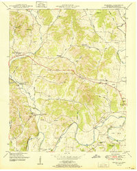
Editions of this 1951 Boonshill Map
2 editions found
Other maps of this area

1936 · Cornersville
USGS Topo · 1:24,000

1936 · Taft
USGS Topo · 1:24,000

1936 · Belleville
USGS Topo · 1:24,000

1936 · Boonshill
USGS Topo · 1:24,000

1936 · Petersburg
USGS Topo · 1:24,000

1936 · Lincoln
USGS Topo · 1:24,000

1936 · Frankewing
USGS Topo · 1:24,000

1936 · Fayetteville
USGS Topo · 1:24,000

1936 · Dellrose
USGS Topo · 1:24,000

1944 · Shelbyville
USGS Topo · 1:100,000