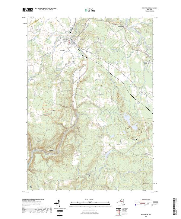
2023 Map of Boonville
USGS Topo · Published 2023About this map
Boonville serves as the primary hub of this 2023 survey, showing a landscape defined by the historical path of the Black River Canal and the village’s established street grid. The settlement patterns follow the corridor of the Black River, with the smaller community of Hawkinsville to the northeast and Hurlbutville situated to the southwest. This modern topographic study reveals how contemporary transportation routes, such as the North Country National Scenic Trail, now traverse the same terrain once dominated by nineteenth-century canal engineering. The local hydrology remains a central feature of the area, with the Black River and its various feeders and reservoirs still anchoring the geographic identity of northern Oneida County.
Find a feature on this map
3 named features on this map. Tap any name to fly to it.
Don’t see what you’re looking for? This feature index may not catch every label — zoom into the map to look around manually.
Map Details
Editions of this 2023 Boonville Map
This is the sole edition of this map. No revisions or reprints were ever made.
Other maps of this area

1897 · Remsen
USGS Topo · 1:62,500

1900 · Remsen
USGS Topo · 1:62,500

1904 · Boonville
USGS Topo · 1:62,500

1905 · Port Leyden
USGS Topo · 1:62,500

1907 · Port Leyden
USGS Topo · 1:62,500

1912 · Mc Keever
USGS Topo · 1:62,500

1940 · Port Leyden
USGS Topo · 1:62,500

1945 · Boonville
USGS Topo · 1:24,000

1945 · Forestport
USGS Topo · 1:24,000
1946 · West Leyden
USGS Topo · 1:31,680