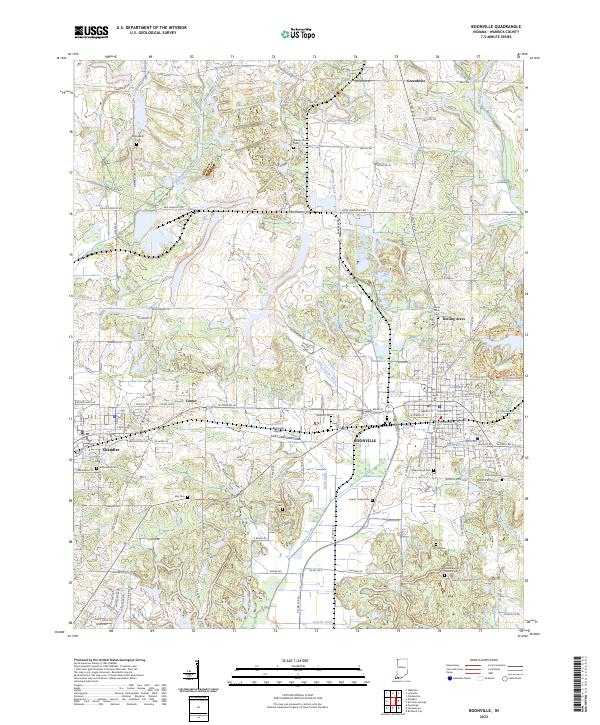
2023 Map of Boonville
USGS Topo · Published 2023About this map
Boonville serves as the focal point of this Warrick County landscape, where the Warrick County Judicial Center anchors the town's grid. The surrounding terrain is defined by an intricate network of agricultural drainage and natural waterways, including the Carter Taylor Ditch and Cypress Creek. To the west, the community of Chandler sits near the Stollberg Ditch, while the northern reaches include the settlement of Greenbrier.
Find a feature on this map
81 named features on this map. Tap any name to fly to it.
Don’t see what you’re looking for? This feature index may not catch every label — zoom into the map to look around manually.
Map Details
Editions of this 2023 Boonville Map
This is the sole edition of this map. No revisions or reprints were ever made.
Other maps of this area

1900 · De Gonia Springs
USGS Topo · 1:62,500

1901 · Owensboro
USGS Topo · 1:62,500

1902 · Ditney
USGS Topo · 1:125,000

1902 · Degonia Springs
USGS Topo · 1:62,500

1902 · Boonville
USGS Topo · 1:62,500

1905 · Newburg
USGS Topo · 1:62,500

1951 · Yankeetown
USGS Topo · 1:24,000

1952 · Newburgh
USGS Topo · 1:24,000

1954 · Evansville
USGS Topo · 1:250,000
1954 · Richland
USGS Topo · 1:24,000