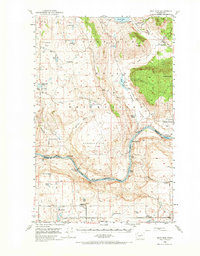
1950 Map of Boot Mtn
USGS Topo · Published 1974About this map
The Colville Indian Reservation Boundary defines much of this landscape in Okanogan and Douglas Counties, where the Columbia River carves a deep path through the plateau. This mid-century survey documents a transition in rural education and community centers, specifically noting the Del Rio School and Ragged Butte School as defunct, while the Del Rio Grange Hall remains a local landmark.
Find a feature on this map
45 named features on this map. Tap any name to fly to it.
Don’t see what you’re looking for? This feature index may not catch every label — zoom into the map to look around manually.
Map Details
Editions of this 1950 Boot Mtn Map
3 editions found
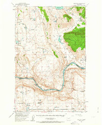
Other maps of this area

1905 · Okanogan
USGS Topo · 1:125,000

1950 · Boot Mtn
USGS Topo · 1:62,500

1950 · Alameda Flat
USGS Topo · 1:62,500

1952 · Alameda Flat
USGS Topo · 1:62,500

1952 · Disautel
USGS Topo · 1:62,500

1953 · Omak Lake
USGS Topo · 1:62,500

1953 · Ritzville
USGS Topo · 1:250,000

1954 · Okanogan
USGS Topo · 1:250,000

1957 · Okanogan
USGS Topo · 1:62,500

1957 · Bridgeport
USGS Topo · 1:62,500