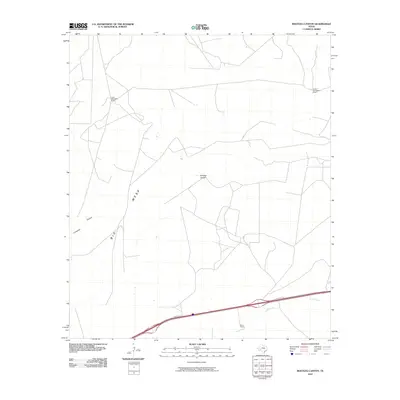
2010 Map of Bootleg Canyon
USGS Topo · Published 2010About this map
Big Mesa dominates the central landscape of this Pecos County region, defining a high plateau that drops away into the deep recesses of Bootleg Canyon. The topography reveals a land shaped by drainage patterns where seasonal water once carved through the limestone, leaving behind Livingston Canyon in the southwest. This area remains largely defined by its traditional ranching heritage, with large landholdings such as the Louis Woodward Ranch and Fannie Woodward Ranch spread across the high ground. In the southern portion of the quadrangle, the modern transportation corridor of Frontage Rd follows the course of Tunas Creek, where the Baker Ranch is situated. The map illustrates the sparsely populated nature of the Trans-Pecos, where life is organized around the rare water sources and the massive scale of the mesas.
Find a feature on this map
8 named features on this map. Tap any name to fly to it.
Don’t see what you’re looking for? This feature index may not catch every label — zoom into the map to look around manually.
Map Details
Editions of this 2010 Bootleg Canyon Map
This is the sole edition of this map. No revisions or reprints were ever made.
Other maps of this area
1928 · Crane
USGS Topo · 1:125,000
1928 · Comanche Spring
USGS Topo · 1:125,000
1929 · Independence Draw Quadrangle
USGS Topo · 1:125,000

1954 · Pecos
USGS Topo · 1:250,000

1954 · Fort Stockton
USGS Topo · 1:250,000

1957 · Pecos
USGS Topo · 1:250,000

1958 · Fort Stockton
USGS Topo · 1:250,000
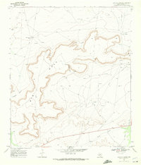
1969 · Bootleg Canyon
USGS Topo · 1:24,000
1969 · Skyscraper Peak
USGS Topo · 1:24,000
1969 · Bakersfield
USGS Topo · 1:24,000