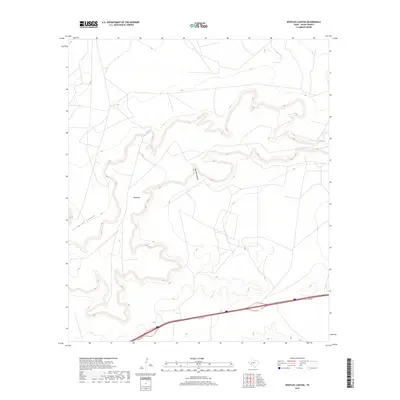
2019 Map of Bootleg Canyon
USGS Topo · Published 2019About this map
Big Mesa dominates the central landscape of this West Texas terrain, serving as a prominent geographical anchor amidst a complex network of eroded drainages. The topography is defined by the winding paths of Bootleg Canyon and Livingston Canyon, which carve through the high ground of Pecos County. While the northern and central portions of the sheet remain relatively undisturbed by modern infrastructure, the southern edge is marked by the presence of the I10 Svc Rd, showing the primary transportation corridor that facilitates movement through this arid region. This detailed survey provides a clear view of the landforms and limited access routes that define the character of the Texas backcountry in the early 21st century.
Find a feature on this map
4 named features on this map. Tap any name to fly to it.
Don’t see what you’re looking for? This feature index may not catch every label — zoom into the map to look around manually.
Map Details
Editions of this 2019 Bootleg Canyon Map
This is the sole edition of this map. No revisions or reprints were ever made.
Other maps of this area

1928 · Crane
USGS Topo · 1:125,000

1928 · Comanche Spring
USGS Topo · 1:125,000

1929 · Independence Draw Quadrangle
USGS Topo · 1:125,000

1954 · Pecos
USGS Topo · 1:250,000

1954 · Fort Stockton
USGS Topo · 1:250,000

1957 · Pecos
USGS Topo · 1:250,000

1958 · Fort Stockton
USGS Topo · 1:250,000

1969 · Bootleg Canyon
USGS Topo · 1:24,000

1969 · Skyscraper Peak
USGS Topo · 1:24,000

1969 · Bakersfield
USGS Topo · 1:24,000