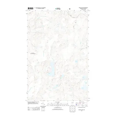
2013 Map of Bootleg Lake
USGS Topo · Published 2013About this map
Superior National Forest encompasses this aquatic landscape of the Boundary Waters region, defined by an intricate network of interconnected waterways and glacial basins. The Little Indian Sioux River and the Moose River serve as the primary drainage arteries, with the former featuring Sioux Falls near the confluence of Spike Horn Cr. This 2013 survey illustrates a wilderness nearly devoid of modern development, save for the presence of Co Hwy 116 and Forest Rte 464 in the northeastern corner. The interior is accessible only via water and portage, connecting notable bodies such as Bootleg Lake, Canthook Lake, and Bezhik Lake. The persistence of indigenous-derived naming conventions like Bezhik Cr, Niswi Lake, and Neesh Lake provides a clear linguistic link to the region's Ojibwe heritage, while labels like Triumph Lake and Serenade Lake reflect more recent recreational naming traditions.
Find a feature on this map
26 named features on this map. Tap any name to fly to it.
Don’t see what you’re looking for? This feature index may not catch every label — zoom into the map to look around manually.
Map Details
Editions of this 2013 Bootleg Lake Map
This is the sole edition of this map. No revisions or reprints were ever made.
Other maps of this area

1954 · Hibbing
USGS Topo · 1:250,000

1954 · International Falls
USGS Topo · 1:250,000

1956 · Sioux Pine Island
USGS Topo · 1:24,000

1956 · Chad Lake
USGS Topo · 1:24,000

1956 · Crab Lake
USGS Topo · 1:24,000

1957 · Hibbing
USGS Topo · 1:250,000

1957 · International Falls
USGS Topo · 1:250,000

1958 · International Falls
USGS Topo · 1:250,000

1958 · Hibbing
USGS Topo · 1:250,000

1963 · Astrid Lake
USGS Topo · 1:24,000