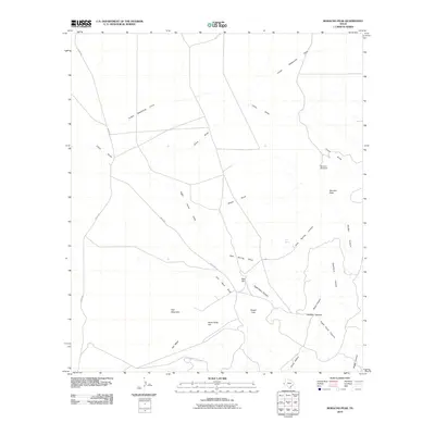
2010 Map of Boracho Peak
USGS Topo · Published 2010About this map
Boracho Peak rises above a landscape defined by an intricate network of desert drainages and seasonal water sources in Culberson County. The area’s reliance on water is etched into the map through features like Indian Waterhole Draw and the Boracho Windmill, reflecting the ranching infrastructure necessary to survive this arid environment. The terrain is marked by distinctive elevations such as Gap Mountain, Flat Mesa, and Red Hill, while the southern reaches are carved by steep features including Deadman Canyon and Right Hand Canyon. Human activity is primarily limited to essential routes like Moon Rd and Taylor Rd, which navigate between the draws and canyons. This survey documents the persistent connection between the high-desert topography and the critical management of water, where even small features like Joes Spring served as vital landmarks for those traversing the Trans-Pecos region.
Find a feature on this map
23 named features on this map. Tap any name to fly to it.
Don’t see what you’re looking for? This feature index may not catch every label — zoom into the map to look around manually.
Map Details
Editions of this 2010 Boracho Peak Map
This is the sole edition of this map. No revisions or reprints were ever made.
Other maps of this area

1892 · Chispa
USGS Topo · 1:125,000

1894 · Valentine
USGS Topo · 1:125,000

1895 · Chispa
USGS Topo · 1:125,000

1897 · Valentine
USGS Topo · 1:125,000

1897 · Chispa
USGS Topo · 1:125,000

1906 · Van Horn
USGS Topo · 1:125,000

1928 · Kent
USGS Topo · 1:125,000

1943 · Valentine
USGS Topo · 1:125,000

1954 · Van Horn
USGS Topo · 1:250,000

1958 · Van Horn
USGS Topo · 1:250,000