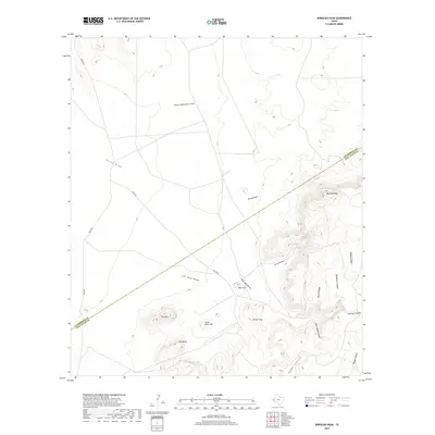
2019 Map of Boracho Peak
USGS Topo · Published 2019About this map
Boracho Peak rises above a landscape defined by an intricate network of drainage draws and canyons across the Culberson Co Jeff Davis Co line. This arid terrain is marked by significant topographical landmarks such as Gap Mtn, Flat Mesa, and Bronc Mule Hill, reflecting a region where water sources like Joes Spring are critical focal points. The map reveals the sparse infrastructure of the Trans-Pecos, with only Moon RD and Taylor RD traversing the broad valleys. A complex system of ephemeral waterways, including Indian Waterhole Draw and Wreck Draw, illustrates the natural drainage patterns that have shaped the ranching and livestock history of this part of West Texas. Named features like Deadman Canyon and Rough Trap hint at the challenging geography faced by early travelers and residents in this remote corner of the state.
Find a feature on this map
23 named features on this map. Tap any name to fly to it.
Don’t see what you’re looking for? This feature index may not catch every label — zoom into the map to look around manually.
Map Details
Editions of this 2019 Boracho Peak Map
This is the sole edition of this map. No revisions or reprints were ever made.
Other maps of this area

1892 · Chispa
USGS Topo · 1:125,000

1894 · Valentine
USGS Topo · 1:125,000

1895 · Chispa
USGS Topo · 1:125,000

1897 · Valentine
USGS Topo · 1:125,000

1897 · Chispa
USGS Topo · 1:125,000

1906 · Van Horn
USGS Topo · 1:125,000

1928 · Kent
USGS Topo · 1:125,000

1943 · Valentine
USGS Topo · 1:125,000

1954 · Van Horn
USGS Topo · 1:250,000

1958 · Van Horn
USGS Topo · 1:250,000