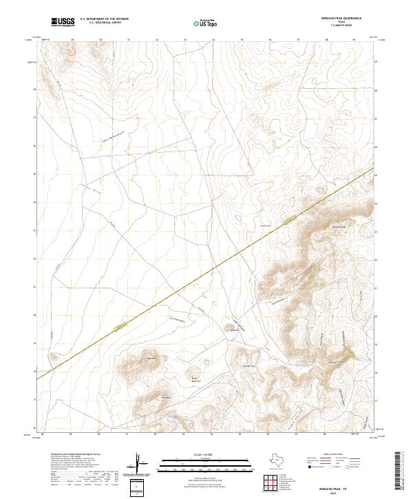
2022 Map of Boracho Peak
USGS Topo · Published 2022About this map
Boracho Peak dominates the high ground along the shared boundary of Culberson and Jeff Davis counties, anchoring a network of ephemeral drainages and named summits. This arid landscape is defined by its dramatic relief, where features like Flat Mesa and Bronc Mule Hill rise above the surrounding flats. The drainages, including Indian Waterhole Draw and China Draw, speak to the critical role of water in this desert environment, marking the natural paths through the high country.
Find a feature on this map
16 named features on this map. Tap any name to fly to it.
Don’t see what you’re looking for? This feature index may not catch every label — zoom into the map to look around manually.
Map Details
Editions of this 2022 Boracho Peak Map
This is the sole edition of this map. No revisions or reprints were ever made.
Other maps of this area

1892 · Chispa
USGS Topo · 1:125,000

1894 · Valentine
USGS Topo · 1:125,000

1895 · Chispa
USGS Topo · 1:125,000

1897 · Valentine
USGS Topo · 1:125,000

1897 · Chispa
USGS Topo · 1:125,000

1906 · Van Horn
USGS Topo · 1:125,000

1928 · Kent
USGS Topo · 1:125,000

1943 · Valentine
USGS Topo · 1:125,000

1954 · Van Horn
USGS Topo · 1:250,000

1958 · Van Horn
USGS Topo · 1:250,000