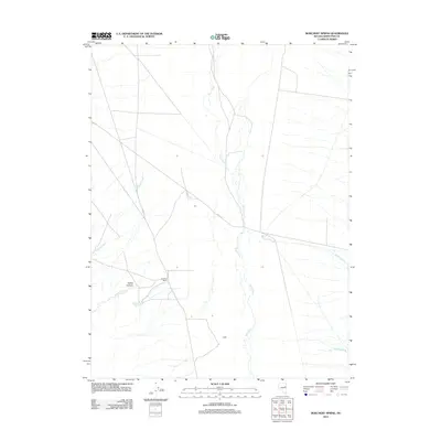
2012 Map of Borchert Spring
USGS Topo · Published 2012About this map
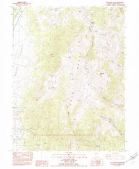
Borchert Ranch and the eponymous Borchert Spring anchor this high-desert landscape in White Pine County, Nevada. The terrain is defined by the north-south flow of Duck Creek, which serves as a central drainage for several tributary systems including Schell Creek and Antone Creek. This 2012 survey illustrates the sparse, ranch-oriented settlement patterns of the region, where isolated named locales like Ray and Raiff are connected by secondary routes such as Co RD 18 and Co RD 27. To the west, the topography transitions into more complex landforms around Rabbit Canyon and Rabbit Creek, while Tehama Creek drains the southeastern portion of the quadrangle. The map captures a moment of modern land use in a region where water sources like springs and perennial creeks remain the primary drivers of human habitation and infrastructure.
Find a feature on this map
12 named features on this map. Tap any name to fly to it.
Don’t see what you’re looking for? This feature index may not catch every label — zoom into the map to look around manually.
Map Details
Editions of this 2012 Borchert Spring Map
This is the sole edition of this map. No revisions or reprints were ever made.
Other maps of this area

1956 · Ely
USGS Topo · 1:250,000

1959 · Ely
USGS Topo · 1:250,000

1963 · Ely
USGS Topo · 1:250,000

1982 · Borchert Spring
USGS Topo · 1:24,000

1982 · Exchequer Spring
USGS Topo · 1:24,000

1982 · Cherry Spring
USGS Topo · 1:24,000
1982 · Monte Neva Hot Springs
USGS Topo · 1:24,000
1982 · Cherry Creek Station
USGS Topo · 1:24,000
1982 · Schellbourne
USGS Topo · 1:24,000
1982 · Telegraph Peak
USGS Topo · 1:24,000