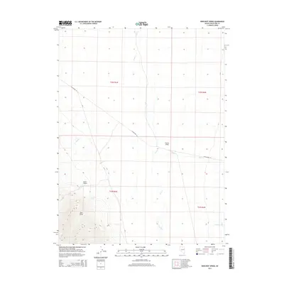
2014 Map of Borchert Spring
USGS Topo · Published 2014About this map
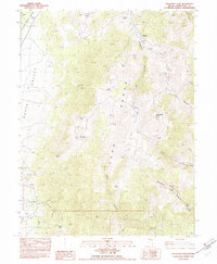
Borchert Spring sits at the base of the Egan Range, marking a vital water source where the mountains meet the expansive Steptoe Valley. This corner of White Pine County is characterized by its high-altitude drainage systems, with Rabbit Creek flowing out of Rabbit Canyon and multiple seasonal streams like Antone Creek and Tehama Creek descending toward the valley floor. The landscape is structured by the historic Schellbourne Rd, a route that follows the natural contours of the basin, and Duck Creek, which meanders north through the flats. The map provides a detailed view of the Public Land Survey System grid, including t23n r63e and surrounding townships, which remains the primary framework for land ownership and grazing rights in this part of the Great Basin.
Find a feature on this map
15 named features on this map. Tap any name to fly to it.
Don’t see what you’re looking for? This feature index may not catch every label — zoom into the map to look around manually.
Map Details
Editions of this 2014 Borchert Spring Map
This is the sole edition of this map. No revisions or reprints were ever made.
Other maps of this area

1956 · Ely
USGS Topo · 1:250,000

1959 · Ely
USGS Topo · 1:250,000

1963 · Ely
USGS Topo · 1:250,000

1982 · Borchert Spring
USGS Topo · 1:24,000

1982 · Exchequer Spring
USGS Topo · 1:24,000

1982 · Cherry Spring
USGS Topo · 1:24,000
1982 · Monte Neva Hot Springs
USGS Topo · 1:24,000
1982 · Cherry Creek Station
USGS Topo · 1:24,000
1982 · Schellbourne
USGS Topo · 1:24,000
1982 · Telegraph Peak
USGS Topo · 1:24,000