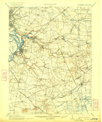
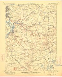
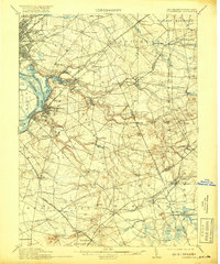
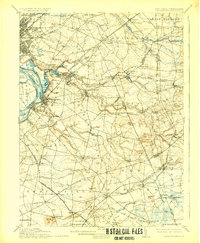
1906 Map of Bordentown
USGS Topo · Published 1922About this map
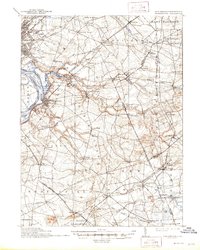
Bordentown serves as a focal point for this early 20th-century landscape where the Delaware River meets an intricate network of inland waterways and rail lines. The convergence of the Pennsylvania Railroad Amboy Div. and the Kinkora Branch highlights the era's transport-driven growth across the New Jersey and Pennsylvania border. Small agricultural and industrial hubs like Yardville and Allentown are depicted alongside numerous milling sites, including Carsons Mills and Hutchinsons Mill, which were vital to the local economy.
Find a feature on this map
112 named features on this map. Tap any name to fly to it.
Don’t see what you’re looking for? This feature index may not catch every label — zoom into the map to look around manually.
Map Details
Editions of this 1906 Bordentown Map
6 editions found

Other maps of this area

1884 · Whitings
USGS Topo · 1:62,500

1888 · Bordentown
USGS Topo · 1:62,500

1888 · Pemberton
USGS Topo · 1:62,500

1888 · New Brunswick
USGS Topo · 1:62,500

1888 · Mount Holly
USGS Topo · 1:62,500

1888 · Princeton
USGS Topo · 1:62,500

1888 · Cassville
USGS Topo · 1:62,500

1888 · Whitings
USGS Topo · 1:62,500

1890 · Lambertville
USGS Topo · 1:62,500

1890 · Burlington
USGS Topo · 1:62,500