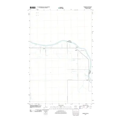
2010 Map of Border
USGS Topo · Published 2010About this map
Rainy River defines the international boundary between Minnesota and Ontario in this northern borderland region. The landscape is characterized by a sparse network of rural roads that connect small, isolated settlements such as Central, Border, and Frontier. These communities are linked by routes like County Hwy 4 and the descriptively named Frontier Farmers Rd, which reflect the area's agricultural and frontier identity. Local history and genealogy are anchored at Riverdale Cemetery, located near the riverbank where Whitefish Creek feeds into the main waterway. This map provides a clear record of the small-scale settlement patterns and essential infrastructure that sustained this remote international crossing during the early 21st century.
Find a feature on this map
15 named features on this map. Tap any name to fly to it.
Don’t see what you’re looking for? This feature index may not catch every label — zoom into the map to look around manually.
Map Details
Editions of this 2010 Border Map
This is the sole edition of this map. No revisions or reprints were ever made.
Other maps of this area

1919 · Birchdale
USGS Topo · 1:62,500

1954 · Roseau
USGS Topo · 1:250,000

1957 · Roseau
USGS Topo · 1:250,000

1958 · Roseau
USGS Topo · 1:250,000

1968 · Clementson
USGS Topo · 1:24,000

1968 · Birchdale SW
USGS Topo · 1:24,000

1968 · Stratton
USGS Topo · 1:24,000

1968 · Border
USGS Topo · 1:24,000

1968 · Clementson SW
USGS Topo · 1:24,000

1968 · Clementson SE
USGS Topo · 1:24,000