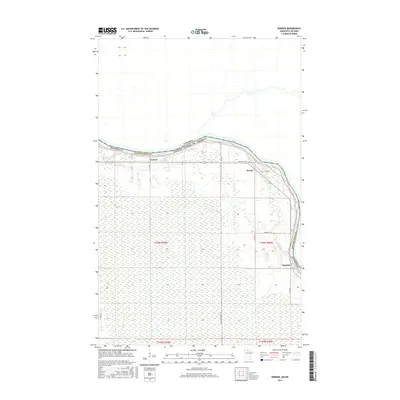
2016 Map of Border
USGS Topo · Published 2016About this map
Rainy River forms a defining international boundary in this 2016 survey, separating Minnesota and Canada at the northern edge of Koochiching County. The landscape south of the river is characterized by extensive wetlands and a grid of rural infrastructure, including Co Hwy 4 and Frontier Farmers Rd. The small settlements of Border and Frontier sit along the river's path, while Central marks a point further west. These hamlets represent the sparse but persistent human footprint in this boreal borderland. For local history researchers, the map provides precise locations for landmarks like Riverdale Cem and the drainage patterns of Whitefish Cr as it feeds into the main river channel. The interplay between the natural waterways and the rigid Public Land Survey System lines illustrates the 20th-century effort to organize and settle this wet, northern terrain.
Find a feature on this map
19 named features on this map. Tap any name to fly to it.
Don’t see what you’re looking for? This feature index may not catch every label — zoom into the map to look around manually.
Map Details
Editions of this 2016 Border Map
This is the sole edition of this map. No revisions or reprints were ever made.
Other maps of this area

1919 · Birchdale
USGS Topo · 1:62,500

1954 · Roseau
USGS Topo · 1:250,000

1957 · Roseau
USGS Topo · 1:250,000

1958 · Roseau
USGS Topo · 1:250,000

1968 · Clementson
USGS Topo · 1:24,000

1968 · Birchdale SW
USGS Topo · 1:24,000

1968 · Stratton
USGS Topo · 1:24,000

1968 · Border
USGS Topo · 1:24,000

1968 · Clementson SW
USGS Topo · 1:24,000

1968 · Clementson SE
USGS Topo · 1:24,000