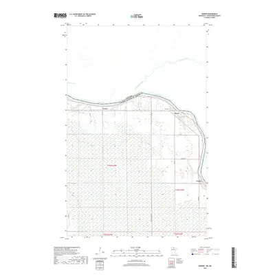
2019 Map of Border
USGS Topo · Published 2019About this map
The Rainy River defines the international boundary between Canada and the United States in this northern landscape, winding past the small settlements of Central, Border, and Frontier. The terrain is marked by extensive wetlands and minor tributaries like Whitefish Cr and Cemetery Cr, which feed into the main river system. Local history is anchored at Riverdale Cem, located just west of the Border settlement. The map reveals a rural infrastructure of township and county roads, including Town Rd 129 and Frontier Farmers Rd, that service the scattered homesteads and agricultural plots north of the river's bend. This 2019 survey reflects the enduring character of this borderland, where the proximity to the Pinewood River confluence across the border remains a central geographic feature.
Find a feature on this map
24 named features on this map. Tap any name to fly to it.
Don’t see what you’re looking for? This feature index may not catch every label — zoom into the map to look around manually.
Map Details
Editions of this 2019 Border Map
This is the sole edition of this map. No revisions or reprints were ever made.
Other maps of this area

1919 · Birchdale
USGS Topo · 1:62,500

1954 · Roseau
USGS Topo · 1:250,000

1957 · Roseau
USGS Topo · 1:250,000

1958 · Roseau
USGS Topo · 1:250,000

1968 · Clementson
USGS Topo · 1:24,000

1968 · Birchdale SW
USGS Topo · 1:24,000

1968 · Stratton
USGS Topo · 1:24,000

1968 · Border
USGS Topo · 1:24,000

1968 · Clementson SW
USGS Topo · 1:24,000

1968 · Clementson SE
USGS Topo · 1:24,000