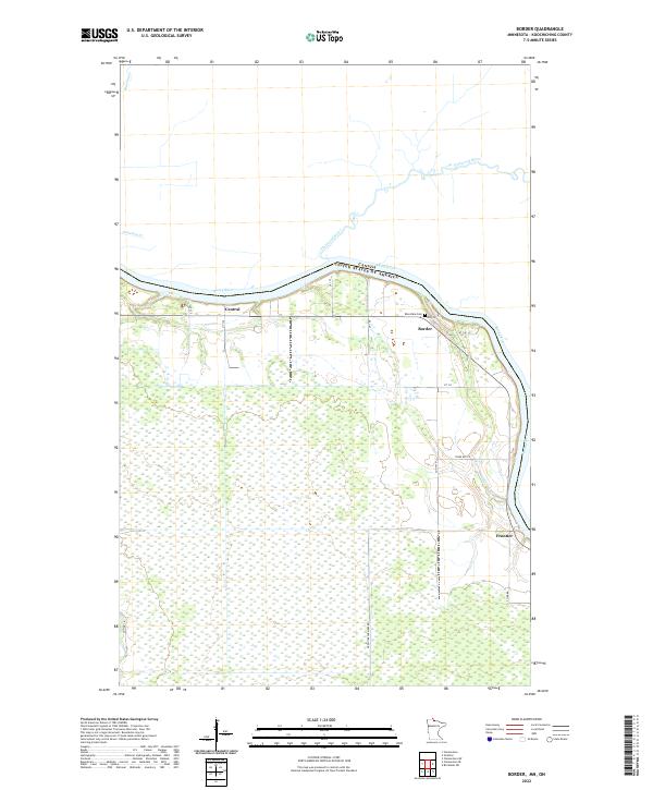
2022 Map of Border
USGS Topo · Published 2022About this map
The Rainy River forms a definitive international boundary between the United States and Canada, anchoring a landscape defined by its waterways and small northern settlements. In this 2022 survey of Koochiching County, the communities of Border and Frontier sit along the river's edge, while Central marks a small interior cluster further west. The terrain is characterized by extensive wetlands and a network of creeks including Whitefish Cr, Bunting Cr, and the appropriately named Cemetery Cr, which flows near the Canadian border. Local history is preserved at the Riverdale Cem, located just south of the Pinewood River confluence. The map documents a rural infrastructure of township roads and unpaved routes such as Frontier Farmers Rd, illustrating how land use and transportation in this remote corner of Minnesota remain tied to the river's path.
Find a feature on this map
26 named features on this map. Tap any name to fly to it.
Don’t see what you’re looking for? This feature index may not catch every label — zoom into the map to look around manually.
Map Details
Editions of this 2022 Border Map
This is the sole edition of this map. No revisions or reprints were ever made.
Other maps of this area

1919 · Birchdale
USGS Topo · 1:62,500

1954 · Roseau
USGS Topo · 1:250,000

1957 · Roseau
USGS Topo · 1:250,000

1958 · Roseau
USGS Topo · 1:250,000

1968 · Clementson
USGS Topo · 1:24,000

1968 · Birchdale SW
USGS Topo · 1:24,000

1968 · Stratton
USGS Topo · 1:24,000

1968 · Border
USGS Topo · 1:24,000

1968 · Clementson SW
USGS Topo · 1:24,000

1968 · Clementson SE
USGS Topo · 1:24,000