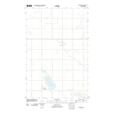
2011 Map of Bordulac
USGS Topo · Published 2011About this map
Bordulac occupies a quiet corner of Foster County, where the plains are defined by glacial lakes and a precise grid of rural roads. This 2011 survey highlights a landscape dominated by the expansive Lake George, which sits just north of the settlement. To the east, the appropriately named Dry Lake illustrates the ephemeral nature of water in this prairie environment. The drainage of Kelly Creek moves through the northern and central portions of the quadrangle, punctuated by the Kelly Creek Dam. The road network, including Main St E and numerous numbered avenues like 75th Ave NE, reflects the organized section-line planning of the North Dakota interior, where small communities like Bordulac serves as central points for the surrounding agricultural tracts.
Find a feature on this map
22 named features on this map. Tap any name to fly to it.
Don’t see what you’re looking for? This feature index may not catch every label — zoom into the map to look around manually.
Map Details
Editions of this 2011 Bordulac Map
This is the sole edition of this map. No revisions or reprints were ever made.
Other maps of this area

1900 · Pingree
USGS Topo · 1:125,000

1944 · Brantford
USGS Topo · 1:62,500

1946 · Brantford
USGS Topo · 1:62,500

1948 · New Rockford
USGS Topo · 1:62,500

1948 · Carrington
USGS Topo · 1:62,500

1949 · Grace City
USGS Topo · 1:24,000

1950 · Carrington East
USGS Topo · 1:24,000

1950 · Melville
USGS Topo · 1:24,000

1950 · Grace City
USGS Topo · 1:24,000

1950 · Brantford
USGS Topo · 1:24,000