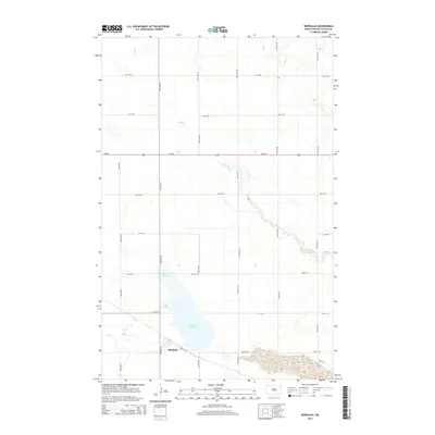
2014 Map of Bordulac
USGS Topo · Published 2014About this map
Bordulac stands as the primary settlement in this section of Foster County, situated at the intersection of a grid-based road network and several local routes like Bordulal St. The geography is defined by a series of prairie depressions and water features, most notably the expansive Lake George, which dominates the southern landscape. Running through the central and northern reaches, Kelly Creek (also labeled Kelly Cr in its upper stretches) provides the primary drainage for the area. The map illustrates a highly organized agricultural layout, with long avenues such as 74th Ave NE and 77th Ave NE bisecting the terrain. The presence of ND-200 serves as the main east-west artery, connecting this rural community to the broader North Dakota transport system.
Find a feature on this map
26 named features on this map. Tap any name to fly to it.
Don’t see what you’re looking for? This feature index may not catch every label — zoom into the map to look around manually.
Map Details
Editions of this 2014 Bordulac Map
This is the sole edition of this map. No revisions or reprints were ever made.
Other maps of this area

1900 · Pingree
USGS Topo · 1:125,000

1944 · Brantford
USGS Topo · 1:62,500

1946 · Brantford
USGS Topo · 1:62,500

1948 · New Rockford
USGS Topo · 1:62,500

1948 · Carrington
USGS Topo · 1:62,500

1949 · Grace City
USGS Topo · 1:24,000

1950 · Carrington East
USGS Topo · 1:24,000

1950 · Melville
USGS Topo · 1:24,000

1950 · Grace City
USGS Topo · 1:24,000

1950 · Brantford
USGS Topo · 1:24,000