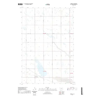
2020 Map of Bordulac
USGS Topo · Published 2020About this map
Bordulac stands as the primary settlement in this corner of Foster County, positioned near the southern edge of the survey. The landscape is defined by the prairie potholes and drainage patterns of the northern plains, characterized by the winding course of Kelly Cr as it meanders through the township sections. Large bodies of water, most notably Lake George, dominate the southern portion of the map, illustrating the significant wetland presence typical of this region of North Dakota. The area is structured by a precise grid of rural roads, including 74th Ave NE and Main St E, which provide access to the dispersed farmsteads and agricultural plots that define the local economy. This survey documents the intersection of several townships, including t146n r65w and t145n r65w, reflecting the enduring land division system established during the initial settlement of the Dakotas.
Find a feature on this map
22 named features on this map. Tap any name to fly to it.
Don’t see what you’re looking for? This feature index may not catch every label — zoom into the map to look around manually.
Map Details
Editions of this 2020 Bordulac Map
This is the sole edition of this map. No revisions or reprints were ever made.
Other maps of this area

1900 · Pingree
USGS Topo · 1:125,000

1944 · Brantford
USGS Topo · 1:62,500

1946 · Brantford
USGS Topo · 1:62,500

1948 · New Rockford
USGS Topo · 1:62,500

1948 · Carrington
USGS Topo · 1:62,500

1949 · Grace City
USGS Topo · 1:24,000

1950 · Carrington East
USGS Topo · 1:24,000

1950 · Melville
USGS Topo · 1:24,000

1950 · Grace City
USGS Topo · 1:24,000

1950 · Brantford
USGS Topo · 1:24,000