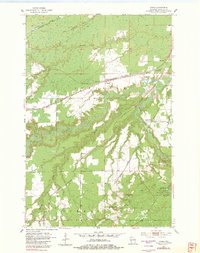
1954 Map of Borea
USGS Topo · Published 1982About this map
The Nemadji River and its numerous tributaries, including Clear Creek and Balsam Creek, dominate this Douglas County landscape during the mid-1950s. The area is defined by a dense concentration of competing rail lines, with the Northern Pacific, Great Northern, and the Minneapolis St Paul and Sault Ste Marie all cutting through the terrain. These tracks linked small rail settlements like Borea, Dedham, and Boylston to larger regional hubs, while the northern edge near Anton shows the convergence of the Chicago Milwaukee St Paul and Pacific line.
Find a feature on this map
25 named features on this map. Tap any name to fly to it.
Don’t see what you’re looking for? This feature index may not catch every label — zoom into the map to look around manually.
Map Details
Editions of this 1954 Borea Map
2 editions found
Other maps of this area

1915 · Superior
USGS Topo · 1:48,000

1917 · Superior
USGS Topo · 1:62,500

1949 · Holyoke
USGS Topo · 1:48,000

1949 · Patzau
USGS Topo · 1:48,000

1953 · Duluth
USGS Topo · 1:250,000

1954 · West Duluth
USGS Topo · 1:24,000

1954 · Borea
USGS Topo · 1:24,000

1954 · Foxboro
USGS Topo · 1:24,000

1954 · Sunnyside
USGS Topo · 1:24,000
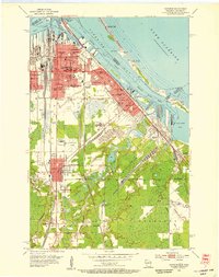
1954 · Superior
USGS Topo · 1:24,000