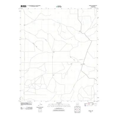
2010 Map of Borica
USGS Topo · Published 2010About this map
Borica serves as the central point of this high-desert ranching landscape in Guadalupe County. The settlement pattern is defined by family-run operations scattered across the arid terrain, including Montoya Ranch, White Ranch, and Gonzales Ranch. These homesteads are connected by a sparse network of rural routes like County Rd-3 and Creek Road 3C1, which navigate the natural drainage systems of the region. The map highlights the essential relationship between land use and topography, with Borica Draw cutting a significant path through the center of the quadrangle while Carrizo Creek and Puerto Creek provide the primary hydrological features for the surrounding rangeland. This 2010 survey records the enduring ranching tradition of eastern New Mexico, where large holdings such as the Mullen Ranch and Powell Ranch maintain their prominence in a wide-open landscape.
Find a feature on this map
13 named features on this map. Tap any name to fly to it.
Don’t see what you’re looking for? This feature index may not catch every label — zoom into the map to look around manually.
Map Details
Editions of this 2010 Borica Map
This is the sole edition of this map. No revisions or reprints were ever made.
Other maps of this area

1954 · Fort Sumner
USGS Topo · 1:250,000

1958 · Fort Sumner
USGS Topo · 1:250,000

1963 · Puerto Creek
USGS Topo · 1:24,000

1963 · Puerto De Luna
USGS Topo · 1:24,000

1966 · Ojo Negro Creek
USGS Topo · 1:24,000

1966 · Borica SW
USGS Topo · 1:24,000

1966 · Cooper Ranch
USGS Topo · 1:24,000

1966 · Borica
USGS Topo · 1:24,000

1978 · El Morro Ranch SE
USGS Topo · 1:24,000

1978 · Laguna De Los Terreros
USGS Topo · 1:24,000