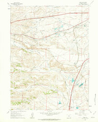
1961 Map of Borie
USGS Topo · Published 1963About this map
The Union Pacific railroad corridor dominates this high plains landscape of Laramie County in the early 1960s, serving as the primary anchor for local settlements and ranching operations. The small rail-adjacent community of Borie sits at a critical junction near the western edge, while Speer marks a point of intersection for the (Burlington) line further southeast. Traces of older transport networks are visible in the Old Railroad Grade that winds through the central hills, bypassing modern tracks.
Find a feature on this map
28 named features on this map. Tap any name to fly to it.
Don’t see what you’re looking for? This feature index may not catch every label — zoom into the map to look around manually.
Map Details
Editions of this 1961 Borie Map
2 editions found
Other maps of this area

1905 · Sherman
USGS Topo · 1:125,000

1907 · Livermore
USGS Topo · 1:125,000

1908 · Eaton
USGS Topo · 1:125,000

1909 · Livermore
USGS Topo · 1:125,000

1910 · Eaton
USGS Topo · 1:125,000

1911 · Cheyenne
USGS Topo · 1:125,000

1914 · Cheyenne
USGS Topo · 1:125,000

1950 · Cheyenne
USGS Topo · 1:62,500

1954 · Cheyenne
USGS Topo · 1:250,000

1954 · Greeley
USGS Topo · 1:250,000