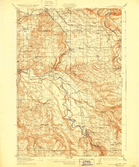
1914 Map of Boring
USGS Topo · Published 1928About this map
The Clackamas River and Sandy River serve as the primary geographical anchors for this region southeast of Portland during the 1910s. The landscape is defined by the early industrial infrastructure of the Pacific Northwest, notably the Cazadero Logging Railroad and the massive Portland Hood Electric Power Company lines that cut through the terrain. River transport remains vital, evidenced by the presence of Mc Murray Ferry and Feldheimer Ferry providing essential crossings before modern bridges dominated the corridor.
Find a feature on this map
72 named features on this map. Tap any name to fly to it.
Don’t see what you’re looking for? This feature index may not catch every label — zoom into the map to look around manually.
Map Details
Editions of this 1914 Boring Map
3 editions found
Other maps of this area

1897 · Portland
USGS Topo · 1:62,500

1905 · Portland
USGS Topo · 1:62,500

1911 · Boring
USGS Topo · 1:48,000

1914 · Boring
USGS Topo · 1:62,500

1914 · Oregon City
USGS Topo · 1:62,500

1916 · Estacada
USGS Topo · 1:125,000

1918 · Troutdale
USGS Topo · 1:62,500

1934 · Troutdale
USGS Topo · 1:48,000

1939 · Molalla
USGS Topo · 1:62,500

1939 · Oregon City
USGS Topo · 1:62,500