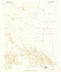
1958 Map of Borrego Mountain SE
USGS Topo · Published 1959About this map
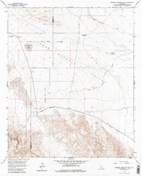
Anza-Borrego Desert State Park dominates the western half of this 1950s survey, illustrating a landscape defined by extreme aridity and topographical transition. The desert floor of the Lower Borrego Valley is etched with drainage features like Fish Creek Wash and San Felipe Creek, while the southern reaches are marked by the dramatic uplift of the Fish Creek Mountains and the distinctive Split Mountain pass. Evidence of early desert transit and limited water resources is found at Harpers Well and along the Old Kane Spring Road.
Find a feature on this map
24 named features on this map. Tap any name to fly to it.
Don’t see what you’re looking for? This feature index may not catch every label — zoom into the map to look around manually.
Map Details
Editions of this 1958 Borrego Mountain SE Map
5 editions found
Other maps of this area

1915 · El Centro
USGS Topo · 1:125,000

1931 · Vallecito
USGS Topo · 1:125,000

1931 · Carrizo
USGS Topo · 1:125,000

1940 · Kane Spring
USGS Topo · 1:62,500

1940 · Plaster City
USGS Topo · 1:62,500

1942 · Barrel Spring
USGS Topo · 1:62,500

1942 · El Centro
USGS Topo · 1:250,000

1942 · Carrizo Mtn
USGS Topo · 1:62,500

1943 · Vallecito
USGS Topo · 1:125,000

1944 · Plaster City
USGS Topo · 1:62,500