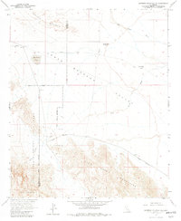
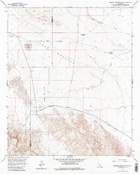
1958 Map of Borrego Mountain SE
USGS Topo · Published 1982About this map
The Lower Borrego Valley floor and the arid Fish Creek Mountains dominate this 1958 survey, conducted as the Anza-Borrego Desert State Park boundaries were established across the Imperial and San Diego county lines. The map reveals the industrial and survival infrastructure of the mid-century desert, most notably a Mining Railroad leading toward a quarry and several dry water sources such as Baileys Well and County Well (Dry) Spring. The settlement of Little Borrego is already noted as a site, while the Old Kane Spring Road provides a primary transit link across the valley. North of the mountains, the Ocotillo Badlands and San Felipe Creek illustrate the stark hydraulic geography of the region, including the seasonal Halfhill Lake and the dramatic gap at Split Mountain.
Find a feature on this map
18 named features on this map. Tap any name to fly to it.
Don’t see what you’re looking for? This feature index may not catch every label — zoom into the map to look around manually.
Map Details
Editions of this 1958 Borrego Mountain SE Map
5 editions found
Other maps of this area

1915 · El Centro
USGS Topo · 1:125,000

1931 · Vallecito
USGS Topo · 1:125,000

1931 · Carrizo
USGS Topo · 1:125,000

1940 · Kane Spring
USGS Topo · 1:62,500

1940 · Plaster City
USGS Topo · 1:62,500

1942 · Barrel Spring
USGS Topo · 1:62,500

1942 · El Centro
USGS Topo · 1:250,000

1942 · Carrizo Mtn
USGS Topo · 1:62,500

1943 · Vallecito
USGS Topo · 1:125,000

1944 · Plaster City
USGS Topo · 1:62,500