Loading...
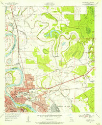
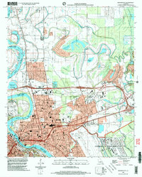
Loading map...1975 Map of Bossier City
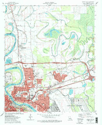
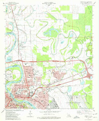
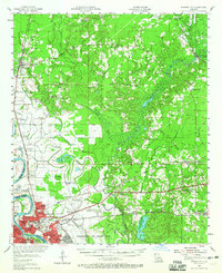
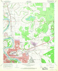
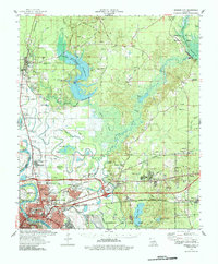
USGS Topo · Published 1976This historical map portrays the area of Bossier City in 1975, primarily covering Bossier Parish as well as portions of Caddo Parish. Featuring a scale of 1:24000, this map provides a highly detailed snapshot of the terrain, roads, buildings, counties, and historical landmarks in the Bossier City region at the time. Published in 1976, it is one of 3 known editions of this map due to revisions or reprints.
Find a feature on this map
5 named features on this map. Tap any name to fly to it.
Don’t see what you’re looking for? This feature index may not catch every label — zoom into the map to look around manually.
Map Details
Date Portrayed1975
Date Published1976
PublisherU.S. Geological Survey
Map TypeTopographic
Scale1:24000
Physical Dimensions21.7 x 26.8 inches
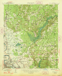
Editions of this 1975 Bossier City Map
3 editions found
Historical Maps of Airline Park Estates Through Time
7 maps found
Featured Locations
Source Details
SourceU.S. Geological Survey
CopyrightPublic Domain