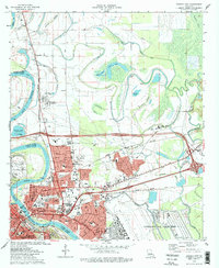
1975 Map of Bossier City
USGS Topo · Published 1978About this map
Barksdale Air Force Base dominates the southeastern quadrant of this mid-1970s landscape, reflecting the military's significant footprint near the Red River corridor. The urban expansion of Bossier City and Shreveport is captured in detail, showing a dense network of residential streets like Melrose Ave and Bonn St alongside established institutions such as Airline Community College and Rusheon Jr High Sch.
Find a feature on this map
90 named features on this map. Tap any name to fly to it.
Don’t see what you’re looking for? This feature index may not catch every label — zoom into the map to look around manually.
Map Details
Editions of this 1975 Bossier City Map
3 editions found
Other maps of this area

1932 · Bossier SE
USGS Topo · 1:31,680

1932 · Bossier NE
USGS Topo · 1:31,680

1932 · Bossier SW
USGS Topo · 1:31,680

1932 · Shreveport SE
USGS Topo · 1:31,680

1932 · Bossier NW
USGS Topo · 1:31,680

1932 · Shreveport NE
USGS Topo · 1:31,680

1938 · Arnsberg
USGS Topo · 1:31,680

1941 · Forbing
USGS Topo · 1:31,680

1945 · Greenwood
USGS Topo · 1:62,500

1948 · Mooringsport
USGS Topo · 1:62,500