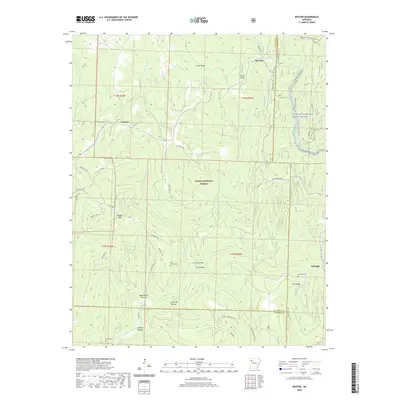
2020 Map of Boston
USGS Topo · Published 2020About this map
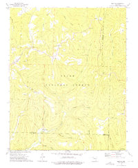
Boston and Red Star anchor this upland landscape within the Ozark National Forest, where the topography is defined by a dense network of hollows and ridges. The map reveals a complex system of trails and headwaters, including the Ozark Highlands Trail and the Trail Of The Ancients, which navigate the high ground around Smith Ridge. Family and community history is preserved through scattered burial grounds like Ratford Cem and Buckhorn Cem, often located near small settlements such as Arbaugh.
Find a feature on this map
54 named features on this map. Tap any name to fly to it.
Don’t see what you’re looking for? This feature index may not catch every label — zoom into the map to look around manually.
Map Details
Editions of this 2020 Boston Map
This is the sole edition of this map. No revisions or reprints were ever made.
Other maps of this area

1889 · Ozone
USGS Topo · 1:62,500

1906 · Batson
USGS Topo · 1:62,500

1934 · Ozone
USGS Topo · 1:62,500

1936 · Ozone
USGS Topo · 1:62,500

1956 · Russellville
USGS Topo · 1:250,000

1964 · Russellville
USGS Topo · 1:250,000
1967 · Fallsville
USGS Topo · 1:24,000
1968 · Boxley
USGS Topo · 1:24,000
1973 · Witter
USGS Topo · 1:24,000
1973 · Boston
USGS Topo · 1:24,000