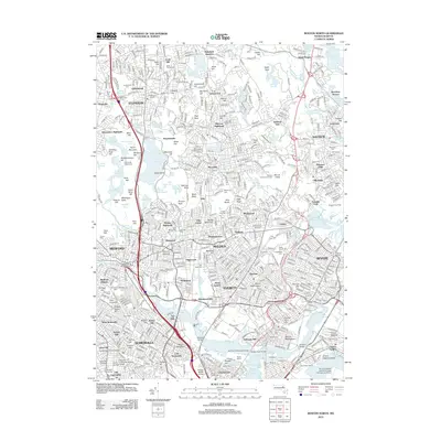
2012 Map of Boston North
USGS Topo · Published 2012About this map
Charlestown and the northern reaches of Cambridge anchor the southern edge of this study, where the Mystic River meets the Boston Inner Harbor. This era shows a densely developed corridor stretching north through Everett and Malden, where industrial and residential sectors are defined by historic cemeteries and massive infrastructure. The M J Tobin Memorial Bridge spans the water, connecting these urban centers to the burgeoning outskirts.
Find a feature on this map
149 named features on this map. Tap any name to fly to it.
Don’t see what you’re looking for? This feature index may not catch every label — zoom into the map to look around manually.
Map Details
Editions of this 2012 Boston North Map
This is the sole edition of this map. No revisions or reprints were ever made.
Other maps of this area

1886 · Lawrence
USGS Topo · 1:62,500

1888 · Lawrence
USGS Topo · 1:62,500

1888 · Salem
USGS Topo · 1:62,500

1892 · Boston Bay
USGS Topo · 1:62,500

1893 · Salem
USGS Topo · 1:62,500

1893 · Boston
USGS Topo · 1:62,500

1893 · Lawrence
USGS Topo · 1:62,500

1903 · Boston
USGS Topo · 1:62,500

1903 · Boston Bay
USGS Topo · 1:62,500

1917 · Salem
USGS Topo · 1:62,500