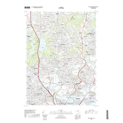
2018 Map of Boston North
USGS Topo · Published 2018About this map
The dense urban and industrial landscape of the north Boston metropolitan area is defined by its deep historical roots and intricate water systems. From the colonial-era Phipps Street Burying Ground near Bunker Hill to the industrial legacy of the Saugus Iron Works National Historic Site, the map reveals a corridor where early American history meets modern infrastructure. The Middlesex Fells reservation provides a significant green space, punctuated by landmarks like Spot Pond and Bear Hill, which overlook a tightly packed network of neighborhoods including Melrose Highlands, Oak Grove, and Edgeworth. Significant maritime and transport features like the M J Tobin Memorial Bridge and the General Edward Lawrence Logan International Airport underscore the region's role as a major hub, while numerous local cemeteries such as the Old Burying Ground Cem and Woodlawn Cem offer touchpoints for genealogical research.
Find a feature on this map
170 named features on this map. Tap any name to fly to it.
Don’t see what you’re looking for? This feature index may not catch every label — zoom into the map to look around manually.
Map Details
Editions of this 2018 Boston North Map
This is the sole edition of this map. No revisions or reprints were ever made.
Other maps of this area

1886 · Lawrence
USGS Topo · 1:62,500

1888 · Lawrence
USGS Topo · 1:62,500

1888 · Salem
USGS Topo · 1:62,500

1892 · Boston Bay
USGS Topo · 1:62,500

1893 · Salem
USGS Topo · 1:62,500

1893 · Boston
USGS Topo · 1:62,500

1893 · Lawrence
USGS Topo · 1:62,500

1903 · Boston
USGS Topo · 1:62,500

1903 · Boston Bay
USGS Topo · 1:62,500

1917 · Salem
USGS Topo · 1:62,500