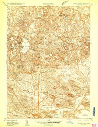
1943 Map of Boston North
USGS Topo · Published 1943About this map
The dense urban and industrial corridors of Middlesex and Suffolk Counties dominate this mid-century survey, revealing a landscape defined by rapid suburban growth and significant institutional footprints. From the concentration of prestigious academic grounds like Harvard University and Radcliffe College in the south to the massive public tracts of the Middlesex Fells Reservation, the map illustrates the complex social geography of the era. The heavy infrastructure supporting the war effort is evident in the US Naval Reservation and the sprawling B and M RR rail yards in East Somerville.
Find a feature on this map
95 named features on this map. Tap any name to fly to it.
Don’t see what you’re looking for? This feature index may not catch every label — zoom into the map to look around manually.
Map Details
Editions of this 1943 Boston North Map
This is the sole edition of this map. No revisions or reprints were ever made.
Other maps of this area

1886 · Lawrence
USGS Topo · 1:62,500

1888 · Lawrence
USGS Topo · 1:62,500

1888 · Salem
USGS Topo · 1:62,500

1892 · Boston Bay
USGS Topo · 1:62,500

1893 · Salem
USGS Topo · 1:62,500

1893 · Boston
USGS Topo · 1:62,500

1893 · Lawrence
USGS Topo · 1:62,500

1903 · Boston
USGS Topo · 1:62,500

1903 · Boston Bay
USGS Topo · 1:62,500

1917 · Salem
USGS Topo · 1:62,500