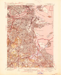
1946 Map of Boston South
USGS Topo · Published 1946About this map
Harvard University and the Massachusetts Institute of Technology anchor the dense urban corridor along the Charles River Basin in this mid-century survey of the metropolitan area. The map illustrates a complex landscape where academic institutions, massive medical centers like Mass General Hospital, and industrial waterfronts meet. Significant green spaces, including Franklin Park and the Arnold Arboretum, break the residential grids of Jamaica Plain and Roslindale.
Find a feature on this map
94 named features on this map. Tap any name to fly to it.
Don’t see what you’re looking for? This feature index may not catch every label — zoom into the map to look around manually.
Map Details
Editions of this 1946 Boston South Map
3 editions found
Other maps of this area

1885 · Abington
USGS Topo · 1:62,500

1886 · Dedham
USGS Topo · 1:62,500

1888 · Abington
USGS Topo · 1:62,500

1892 · Boston Bay
USGS Topo · 1:62,500

1893 · Abington
USGS Topo · 1:62,500

1893 · Boston
USGS Topo · 1:62,500

1894 · Dedham
USGS Topo · 1:62,500

1903 · Boston
USGS Topo · 1:62,500

1903 · Boston Bay
USGS Topo · 1:62,500

1919 · Dedham
USGS Topo · 1:62,500