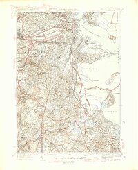
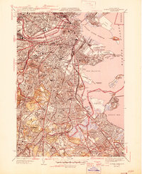
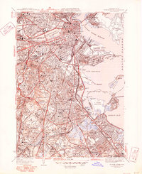
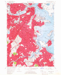
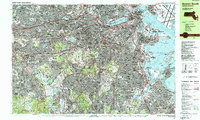
1946 Map of Boston South
USGS Topo · Published 1946About this map
Harvard University and the Mass Institute of Technology anchor the northern bank of the Charles River Basin, documenting the mid-century density of academic and medical institutions. This urban landscape is defined by its extensive healthcare and civic infrastructure, including the Mass General Hospital and the sprawling Boston City Sanatorium. To the south, the terrain shifts into a series of residential neighborhoods and prominent green spaces like Franklin Park, which contains a Zoological Garden.
Find a feature on this map
111 named features on this map. Tap any name to fly to it.
Don’t see what you’re looking for? This feature index may not catch every label — zoom into the map to look around manually.
Map Details
Editions of this 1946 Boston South Map
3 editions found
Historical Maps of Hyde Park Through Time
16 maps found

1944 Boston South
Suffolk County, MA

1944 Hull
Suffolk County, MA
1946 Boston South
Suffolk County, MA
1946 Hull
Suffolk County, MA

1948 Hull
Suffolk County, MA

1949 Hull
Suffolk County, MA

1954 Boston South
Suffolk County, MA
1956 Boston South
Suffolk County, MA
1958 Hull
Suffolk County, MA
1970 Boston South
Suffolk County, MA
1971 Hull
Suffolk County, MA

1977 Boston South
Suffolk County, MA

1977 Hull
Suffolk County, MA
1987 Boston South
Suffolk County, MA
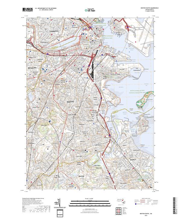
2024 Boston South
Suffolk County, MA
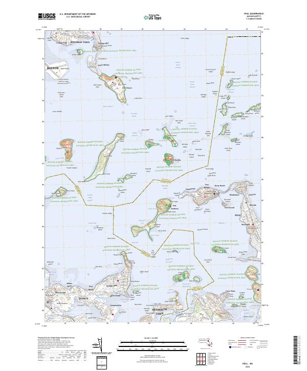
2024 Hull
Suffolk County, MA