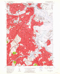
1956 Map of Boston South
USGS Topo · Published 1962About this map
The dense urban corridor from the Charles River Basin south through the historic neighborhoods of Boston and Dorchester is captured here during a period of significant postwar evolution. The map reveals the heavy concentration of institutional land use, from the academic campuses of Harvard University and the Mass Institute of Technology to the sprawling medical complexes of Shattuck State Hospital and Boston State Hospital. These large public and private holdings contrast with the tightly packed residential blocks of South Boston and Roxbury.
Find a feature on this map
180 named features on this map. Tap any name to fly to it.
Don’t see what you’re looking for? This feature index may not catch every label — zoom into the map to look around manually.
Map Details
Editions of this 1956 Boston South Map
Other maps of this area

1885 · Abington
USGS Topo · 1:62,500

1886 · Dedham
USGS Topo · 1:62,500

1888 · Abington
USGS Topo · 1:62,500

1892 · Boston Bay
USGS Topo · 1:62,500

1893 · Abington
USGS Topo · 1:62,500

1893 · Boston
USGS Topo · 1:62,500

1894 · Dedham
USGS Topo · 1:62,500

1903 · Boston
USGS Topo · 1:62,500

1903 · Boston Bay
USGS Topo · 1:62,500

1919 · Dedham
USGS Topo · 1:62,500