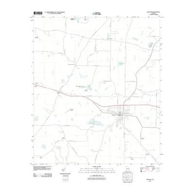
2011 Map of Boston
USGS Topo · Published 2011About this map
Boston serves as the central hub of this Georgia landscape, with its street grid anchored by W Railroad Ave and E Railroad Ave. The town's historical footprint is well-defined by the Boston Post Office and the expansive Boston City Cemetery. To the west, the settlement of Eason sits along the rail line, while the surrounding countryside is characterized by a dense distribution of small, family-named burial grounds.
Find a feature on this map
71 named features on this map. Tap any name to fly to it.
Don’t see what you’re looking for? This feature index may not catch every label — zoom into the map to look around manually.
Map Details
Editions of this 2011 Boston Map
This is the sole edition of this map. No revisions or reprints were ever made.
Other maps of this area

1954 · Valdosta
USGS Topo · 1:250,000

1956 · Grooverville
USGS Topo · 1:24,000

1956 · Monticello NE
USGS Topo · 1:24,000

1956 · Metcalf
USGS Topo · 1:24,000

1957 · Thomasville
USGS Topo · 1:62,500

1958 · Valdosta
USGS Topo · 1:250,000

1959 · Valdosta
USGS Topo · 1:250,000

1961 · Quitman
USGS Topo · 1:62,500
1975 · Thomasville
USGS Topo · 1:24,000
1975 · Merrillville
USGS Topo · 1:24,000