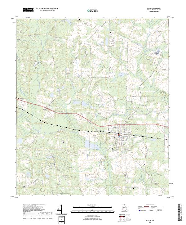
2024 Map of Boston
USGS Topo · Published 2024About this map
Boston serves as the central hub of this Thomas County landscape, where the local street grid meets the path of Old Hwy 84 W. The surrounding terrain is defined by complex hydrology, including the upper reaches of the Aucilla River and the unusual geological depressions at Howell Sinks. Smaller water bodies like Bryan Lake and Turner Pond dot the countryside, while numerous family and community burial grounds, such as Mitchell Family Cem and Bethlehem Cem, provide significant markers for genealogical research. Further west, the settlement of Eason sits along the roadway near Masse Branch, illustrating the rural development pattern of the region. The map also traces the winding course of Piscola Creek and Norton Branch, showing how these waterways influenced the placement of early homesteads and connecting routes like Ozell Rd and Monticello Rd.
Find a feature on this map
84 named features on this map. Tap any name to fly to it.
Don’t see what you’re looking for? This feature index may not catch every label — zoom into the map to look around manually.
Map Details
Editions of this 2024 Boston Map
This is the sole edition of this map. No revisions or reprints were ever made.
Other maps of this area

1954 · Valdosta
USGS Topo · 1:250,000

1956 · Grooverville
USGS Topo · 1:24,000

1956 · Monticello NE
USGS Topo · 1:24,000

1956 · Metcalf
USGS Topo · 1:24,000

1957 · Thomasville
USGS Topo · 1:62,500

1958 · Valdosta
USGS Topo · 1:250,000

1959 · Valdosta
USGS Topo · 1:250,000

1961 · Quitman
USGS Topo · 1:62,500
1975 · Thomasville
USGS Topo · 1:24,000
1975 · Merrillville
USGS Topo · 1:24,000