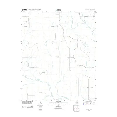
2012 Map of Boswell NW
USGS Topo · Published 2012About this map
Crystal serves as a central point in this rural landscape within Atoka County, where small settlements and cemeteries mark the history of local families. The geography is defined by the winding paths of Muddy Boggy Cr and Clear Boggy Cr, which carve through the terrain and create a network of drainages like Cold Springs Cr and Harrington Br. For genealogists, the map identifies specific burial grounds including the Crystal Cem and Farris Cem, providing precise locations for ancestral research in the area around Old Farris. Small bodies of water, such as Atoka Lake and Boehler Lake near Boehler, suggest a landscape historically tied to local water management and recreation. The grid of section roads, many with descriptive names like E Cottonwood and S Iron Stob Rd, connects these dispersed communities and farmsteads across the Oklahoma countryside.
Find a feature on this map
52 named features on this map. Tap any name to fly to it.
Don’t see what you’re looking for? This feature index may not catch every label — zoom into the map to look around manually.
Map Details
Editions of this 2012 Boswell NW Map
This is the sole edition of this map. No revisions or reprints were ever made.
Other maps of this area

1899 · Atoka
USGS Topo · 1:125,000

1900 · Atoka
USGS Topo · 1:125,000

1901 · Antlers
USGS Topo · 1:125,000

1912 · Antlers
USGS Topo · 1:125,000

1925 · Antlers
USGS Topo · 1:125,000

1950 · Mcalester
USGS Topo · 1:250,000

1957 · Farris
USGS Topo · 1:24,000

1957 · Bruno
USGS Topo · 1:24,000

1957 · Lane
USGS Topo · 1:24,000

1957 · Ardmore
USGS Topo · 1:250,000