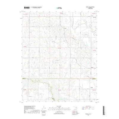
2018 Map of Boswell NW
USGS Topo · Published 2018About this map
Crystal and Old Farris anchor this landscape along the border of Atoka and Choctaw counties. The terrain is defined by the winding course of Muddy Boggy Creek and Clear Boggy Creek, which flow through a region marked by rural roads like Crystal Cemetery Rd and Bachelor Farm Rd. This survey documents a quiet rural pocket where small settlements and family cemeteries, such as Crystal Cem and Farris Cem, serve as the primary landmarks for local genealogists. The presence of water bodies like Atoka Lake and Boehler Lake indicates the importance of local catchments in this part of Oklahoma, while the intersection of several county lines highlights the intricate jurisdictional boundaries of the era.
Find a feature on this map
58 named features on this map. Tap any name to fly to it.
Don’t see what you’re looking for? This feature index may not catch every label — zoom into the map to look around manually.
Map Details
Editions of this 2018 Boswell NW Map
This is the sole edition of this map. No revisions or reprints were ever made.
Other maps of this area

1899 · Atoka
USGS Topo · 1:125,000

1900 · Atoka
USGS Topo · 1:125,000

1901 · Antlers
USGS Topo · 1:125,000

1912 · Antlers
USGS Topo · 1:125,000

1925 · Antlers
USGS Topo · 1:125,000

1950 · Mcalester
USGS Topo · 1:250,000

1957 · Farris
USGS Topo · 1:24,000

1957 · Bruno
USGS Topo · 1:24,000

1957 · Lane
USGS Topo · 1:24,000

1957 · Ardmore
USGS Topo · 1:250,000