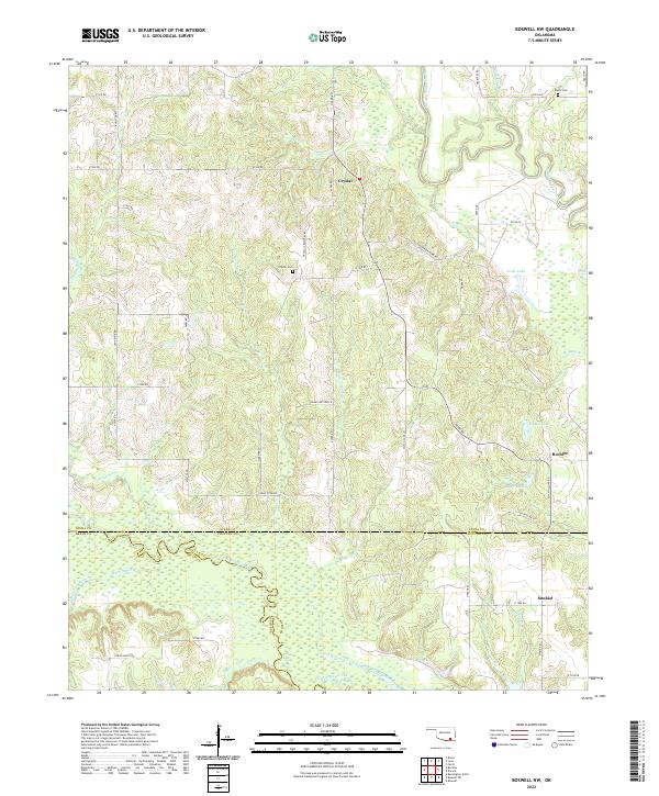
2022 Map of Boswell NW
USGS Topo · Published 2022About this map
Muddy Boggy Creek and Clear Boggy Creek define the drainage of this rural landscape where the boundaries of Atoka, Bryan, and Choctaw counties converge. The small settlements of Crystal, Boehler, and Sunkist serve as focal points for a network of county roads including Bachelor Farm Rd and Jelly Cook Rd. Local heritage is anchored by the Crystal Cem and Farris Cem, while the terrain is marked by numerous water bodies such as Atoka Lake, Boehler Lake, and Hasell Lake. The distribution of these small communities and cemeteries reflects the long-standing agricultural and family-centric layout of this part of southern Oklahoma. The intricate web of local names like Sandy Bottom Ln and Fox Hollow Ln provides a precise map of the homesteads and creek-side dwellings that characterize the region's 21st-century development.
Find a feature on this map
49 named features on this map. Tap any name to fly to it.
Don’t see what you’re looking for? This feature index may not catch every label — zoom into the map to look around manually.
Map Details
Editions of this 2022 Boswell NW Map
This is the sole edition of this map. No revisions or reprints were ever made.
Other maps of this area

1899 · Atoka
USGS Topo · 1:125,000

1900 · Atoka
USGS Topo · 1:125,000

1901 · Antlers
USGS Topo · 1:125,000

1912 · Antlers
USGS Topo · 1:125,000

1925 · Antlers
USGS Topo · 1:125,000

1950 · Mcalester
USGS Topo · 1:250,000

1957 · Farris
USGS Topo · 1:24,000

1957 · Bruno
USGS Topo · 1:24,000

1957 · Lane
USGS Topo · 1:24,000

1957 · Ardmore
USGS Topo · 1:250,000